Chargement de la carte...
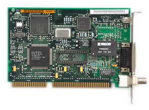
{"format":"leaflet","minzoom":false,"maxzoom":false,"limit":250,"offset":0,"link":"all","sort":[""],"order":[],"headers":"show","mainlabel":"","intro":"","outro":"","searchlabel":"... autres r\u00e9sultats","default":"","import-annotation":false,"width":"auto","height":"350px","centre":false,"title":"","label":"","icon":"","lines":[],"polygons":[],"circles":[],"rectangles":[],"copycoords":false,"static":false,"zoom":false,"defzoom":14,"layers":["OpenStreetMap"],"image layers":[],"overlays":[],"resizable":false,"fullscreen":false,"scrollwheelzoom":true,"cluster":false,"clustermaxzoom":20,"clusterzoomonclick":true,"clustermaxradius":80,"clusterspiderfy":true,"geojson":"","clicktarget":"","showtitle":true,"hidenamespace":true,"template":"","userparam":"","activeicon":"","pagelabel":false,"ajaxcoordproperty":"","ajaxquery":"","locations":[{"text":"\u003Cb\u003E\u003Ca href=\"/wiki/Test_data_with_image\" title=\"Test data with image\"\u003ETest data with image\u003C/a\u003E\u003C/b\u003E\u003Chr /\u003E\u003Ca href=\"/w/index.php?title=Attribut:Main_image\u0026amp;action=edit\u0026amp;redlink=1\" class=\"new\" title=\"Attribut:Main image (page inexistante)\"\u003EMain image\u003C/a\u003E: \u003Ca href=\"/wiki/Fichier:Intel_8_16_LAN_Adapter.jpg\" title=\"Fichier:Intel 8 16 LAN Adapter.jpg\"\u003EFichier:Intel 8 16 LAN Adapter.jpg\u003C/a\u003E","title":"Test data with image","link":"","lat":51.5073346,"lon":-0.12768310000001,"icon":""}],"imageLayers":[]}
